Santa Fe Basecamp home

Santa Fe Basecamp › River guide

Boat & kayak guide · Santa Fe and Suwannee rivers

Spring-hopping the Santa Fe and Suwannee by boat

Dozens of springs line the 31 miles of Santa Fe from River Rise to the Suwannee, plus the stretch of Suwannee from Royal Spring down to Hart Springs. Some have parks and ramps. Others you can only see from a boat. This guide lists them by river mile and covers how to reach each one by motorboat or paddle, where you can land, what's closed this week and how to read the river before you go.

29 stops by river mileMotorboat vs. paddleClosures checked Oct 17, 2026Live USGS gauges
Open the trip planner
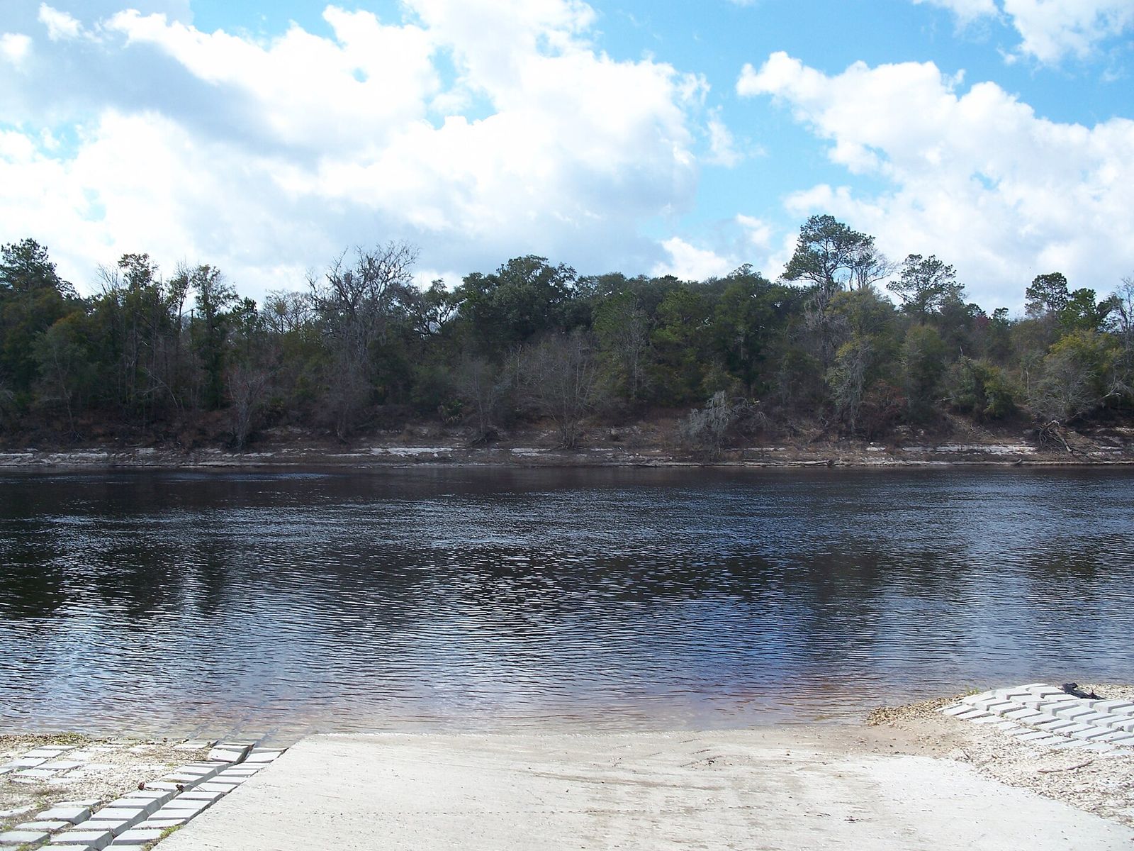
Santa Fe River, Gilchrist County · Michael Rivera, CC BY-SA 4.0

Why stay here

Base yourself where the two rivers meet

Most visitors pick one river and drive to it. From the lower Santa Fe near Branford you can boat either one. Branford's free ramp opens up the springs of the middle Suwannee, and the Santa Fe joins the Suwannee about 10 river miles below town. From there the springs stretch up the Santa Fe to the Ichetucknee mouth and the Ginnie group.

The two rivers are a good match. The Santa Fe is narrow, shaded and calm, and paddlers love it. The Suwannee is broad, with high limestone banks, and in good water a small motorboat can cover a lot of it in a day. On a cool or windy morning, take the sheltered river. On a calm day, take the big one.

Distances on this page are river miles, not driving miles. Suwannee miles come from the Suwannee River Wilderness Trail guide, counted upriver from the Gulf. Santa Fe miles are our own measurement along the river from the Suwannee confluence (mile 0), accurate to about a quarter mile. Treat every distance as an estimate.

From the Branford ramp (Suwannee mi 76)

  • 4.5 miLittle River Springsupstream · county park · swim from the run
  • 6.7 miTroy Springupstream · steamboat wreck · swimming closed now
  • 10 miSanta Fe confluencedownstream · turn up the Santa Fe
  • 17 miIchetucknee River mouth10 mi down the Suwannee + 7 mi up the Santa Fe
  • 18 miPothole Springdownstream · swim stop in low or average water
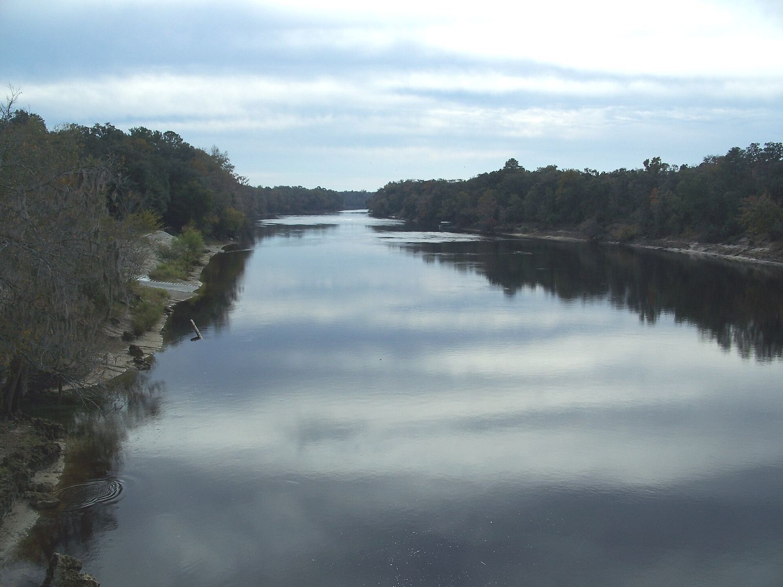
Concrete boat ramp running into the dark Suwannee River at Branford, with a forested far bank
The Suwannee at the Branford ramp · Ebyabe, CC BY-SA 3.0

Map

Every stop on one map

Tap a dot for river mile and status, then use the link to jump to that row in the planner. Spring locations come from OpenStreetMap. Ramp markers are approximate.

Trip planner

Springs by river mile

Listed upstream to downstream. Access shows whether you can reach a spring by motorboat, which assumes a small boat and decent water, or only by paddle. Even where boats can reach a spring, many runs and swim areas are closed to boats, so tie up in the river and swim or wade in. Land? shows whether you can go ashore. Respect private land. Most of these banks are posted.

Show only:
Santa Fe River springs and landings, upstream to downstream, by river mile above the Suwannee
Spring / landmarkMileAccessLand?FeeStatus (Oct 17, 2026)
Santa Fe River RiseWhere the Santa Fe comes back up after about 3 miles underground. The water is tea-colored, not clear. Reach it by paddling about 2.5 miles upstream from the US 441 launch. 31.0 Paddle only State preserve land; landing rules from the water not verified None by water Check firstNo park notice found; access by water is a 2-mile upstream paddle
Columbia SpringA large spring a few hundred yards below the US 441 launch, on private land. Take a quick look before you turn upstream for River Rise. 28.2 Paddle only No. Private land, stay in your boat None Private / view onlyView from the water
Poe SpringsAn Alachua County park and the base for Anderson's Outdoor Adventures. The park, ramp and outfitter are operating, but the spring itself is off-limits. 23.4 Motorboat or paddle Yes, county park with ramp and dock Free Oct–Mar; $6/vehicle May–Sep Closed nowWater area closed (low water) since July; county staff want it shut until January
Lily SpringSmall vents at the head of a short, shaded run. The guidebook describes it as open to visitors coming in from the river, but we couldn't confirm current access. 22.5 Paddle only Private land; swim from the water only unless invited None Check firstNot officially managed, conditions unverified
Pickard SpringRight next to Lily, beside the river. Stay off the dock. 22.4 Paddle only No. Private dock and land None Private / view onlyView from the water
Rum Island SpringA spring basin that opens straight into the river at a county park with a boat ramp. It gets crowded on warm weekends. Jonathan Spring is a short paddle upstream. 21.2 Motorboat or paddle Yes, Columbia County park with boat ramp $5/vehicle by land OpenOpen: 7:30 a.m.–7:30 p.m. (winter 8–5:30)
Gilchrist Blue SpringsQuarter-mile run on the south bank, just below Rum Island. The guidebook notes that a fence blocks boats from the main spring even in normal times. 21.0 Paddle only State park. No day-use access right now $6/vehicle when open Closed nowNo day use during construction (camping only, Oct 1, 2026)
Devil's Eye, Devil's Ear & Little DevilThree vents on the Ginnie property. Devil's Ear opens in the riverbed and draws cave divers, so watch for dive flags and slow to idle. 20.2 Motorboat or paddle Ginnie Springs property. Paid admission to land $25 adult Mar–Oct, $20 Nov–Feb OpenGinnie open: 8–5 Mon–Thu, 8–7 Fri–Sat, 8–6 Sun
July SpringAcross the river from the Ginnie side. Swimmers cross over from Ginnie, so watch for them and for boat traffic. 20.1 Motorboat or paddle No. Posted private bank on the north side None from the river Private / view onlySwim or float in, no landing
Ginnie SpringThe namesake spring of the Ginnie group, with Dogwood, Twin and Deer just downstream. Ginnie's rental canoes and kayaks only go upstream and must be back by 5 p.m. 19.9 Motorboat or paddle Yes, with paid Ginnie admission (on-site ramp) $25 adult Mar–Oct, $20 Nov–Feb; kids $5–6 OpenOpen; no pets, no jet skis, ID required to camp
Sawdust SpringAcross from the downstream end of the Ginnie group. 19.4 Paddle only No. Posted private land None Private / view onlyView from the water
Siphon Creek Rise & Big Awesome SiphonThe river runs both directions here. Water comes up at Siphon Creek Rise, and about a mile above SR 47 it drains back underground at the Big Awesome Siphon, which can form a whirlpool. 17.0 Paddle only South bank is water-management-district land None Check firstSiphons can pull swimmers under. Don't swim near them
SR 47 ramp (Santa Fe River Park) & 47 Boatramp SpringA small spring comes up right by the ramp. Myrtle's Fissure is about 0.3 mile upstream on private land, so stay in the water. 16.1 Motorboat or paddle Yes, public ramp Not verified OpenTake-out for the 8 Springs in 8 Miles paddle
Wilson SpringA spring pool on private land. Below Wilson, the river makes a couple of sharp bends that turn into shoals and small rapids in low water. 13.2 Motorboat or paddle Spring is private; public ramp just below the run None Private / view onlyPaddle in only
Sunbeam SpringA fissure in the middle of the river. In drought you can stand on the limestone and look into the vent. Boats pass close, so fly a dive flag if you snorkel. 9.7 Motorboat or paddle Yes, wade in. It's in the riverbed None OpenBest in low water, hard to see in high water
Ichetucknee River mouthClear blue Ichetucknee water meets the tea-colored Santa Fe. The lower river below US 27 is shallow (around 4 ft on average, under 2 ft in places), so idle in and keep off the grass beds. 7.0 Motorboat or paddle Riverfront homes, no public landing None Check firstBoats allowed up to US 27; no motors inside the state park
Betty SpringA small spring about 1.4 miles upstream of the US 129 ramp. 3.9 Motorboat or paddle No. Posted private bank None Private / view onlyView or swim from the water
Campground & Trail SpringsTwo springs at a riverside campground about a mile below US 129. 1.3 Motorboat or paddle Private campground; fee to land Campground fee Private / view onlyNo unauthorized landing

Also on the upper Santa Fe, between US 441 and River Rise: Darby, Treehouse and Hornsby springs (Hornsby is on private Camp Kulaqua land). Around US 27: Alligator Rise, next to the ramp. Near Ginnie: Jonathan, Dogwood, Twin and Deer, plus Oasis (mi 9.0, private ramp). We left out springs that are hard to find or have no access from the water.

Sample days

Day trips that work

Miles are our estimates of river distance. Motorboat times assume a relaxed 15 to 20 mph between stops, slower in shallows and idle zones. Paddle times assume an easy pace with the current. Swims and lunch take longer than you think.

The wide Suwannee River looking downstream from Branford between wooded banks
Suwannee River below Branford · Ebyabe, CC BY-SA 2.5
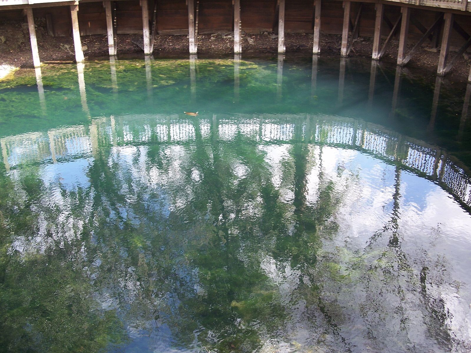
Clear water at Branford Spring, reflecting the wooden deck built around it
Branford Spring at Ivey Memorial Park · Ebyabe, CC BY-SA 3.0

By motorboat

Branford up to Little River, Ruth & Troy

Launch: Ivey Memorial Park, Branford≈ 13–14 mi round tripHalf day

  1. 0 Branford Spring, right at the ramp
  2. 4.5 Little River Springs: anchor off the run and wade the 150 ft in
  3. 4.9 Ruth Spring: beach the boat and walk the 250-ft run
  4. 6.7 Troy Spring: look at the Madison wreck from the run. Swimming is closed for now.

Want more? Royal Spring is another 7.7 miles up (14.4 from Branford). It's a big limestone basin, but in low water it barely flows.

Branford down to Pothole, Rock Bluff & Gornto

Launch: Ivey Memorial Park, Branford≈ 42 mi round tripFull day

  1. 10 Santa Fe confluence. Slow down here (sturgeon holding area).
  2. 17.8 Pothole Spring. Swim in low or average water.
  3. 19.4 Rock Bluff Spring: private, so look but don't land. Also a sturgeon area.
  4. 21 Gornto Spring: county park. Call ahead about reopening.

Check your fuel range before you go. Hart Springs is almost 33 miles down, so for that stretch launch at Hart's own ramp instead.

Lower Santa Fe: Ichetucknee mouth, Sunbeam & Wilson

Launch: US 129 ramp (Santa Fe mi 2.5)≈ 21 mi round tripHalf day

  1. 1.4 Betty Spring: a small blue pool on private land, so view it from the water
  2. 4.5 Ichetucknee mouth: idle a short way up into the clear water
  3. 7.2 Sunbeam Spring, a vent in the riverbed. Wade it in low water.
  4. 10.7 Wilson Spring, just above the public ramp

Below Wilson, the bends get rocky in low water. Trim up and go slow. No motors past US 27 on the Ichetucknee.

Santa Fe from SR 47: Ginnie group & Rum Island

Launch: SR 47 ramp (Santa Fe mi 16.1)≈ 10–15 mi round tripHalf day

  1. 0 47 Boatramp Spring, right off the ramp
  2. 0.9 Siphon Creek Rise. Stay clear of the siphon upstream.
  3. 3.8–4.1 Ginnie, July and the Devil's springs. Idle near dive flags.
  4. 5.1 Rum Island county park. Lily is 1.3 miles farther, and Poe (swim area closed) is 2.2.

This is the shallowest motor trip on the page. Expect limestone, logs and eelgrass, so a jon boat or small skiff with a tilt motor is the right boat. To land at Ginnie you'll need Ginnie admission.

By kayak, canoe or paddleboard

The classic: US 27 to Rum Island or SR 47

Downstream · shuttle needed4 mi (≈ 2 h) or 9–10 mi (≈ 5 h)

This is the stretch most paddlers mean when they say "the Santa Fe." Stops include Poe (swim area closed right now), Lily, Pickard, Jonathan and Rum Island, then the Ginnie group, Twin and Siphon Creek on the longer run. Rum 138 rents boats and runs shuttles for this trip, and the times come from them. Ginnie's springs are a good lunch stop if you're paying for admission.

8 Springs in 8 Miles (guided)

Poe Springs → SR 47≈ 7 mi · ≈ 4.5 h

Anderson's Outdoor Adventures runs this from its base at Poe Springs Park, with a shuttle back. It also runs a shorter Ginnie paddle that includes a Ginnie pass (about 5 mi, about 3.5 h). They're good options if you don't want to arrange your own cars.

US 441 up to River Rise and back

Out and back · no shuttle≈ 5 mi round trip

Paddle upstream first from the free city launch at the old Canoe Outpost, past Columbia, Darby and Treehouse, to the pool where the Santa Fe comes back above ground. The way back is with the current. In low water, plan for some shallow, weedy spots and maybe a short drag.

Suwannee: Ruth Springs launch to Branford

Downstream · bring two cars≈ 6 mi · 3–4 h

Walk into Ruth, then a short way down swim Little River, and finish at Branford Spring by the ramp. We haven't found a shuttle service for this stretch, so plan to run your own. The Suwannee is wide, so a headwind can double your time.

The upper Ichetucknee inside the state park is its own trip. The park says it's best by canoe or kayak in the cooler months, and motors aren't allowed. Check the park page for launch points and seasonal rules.

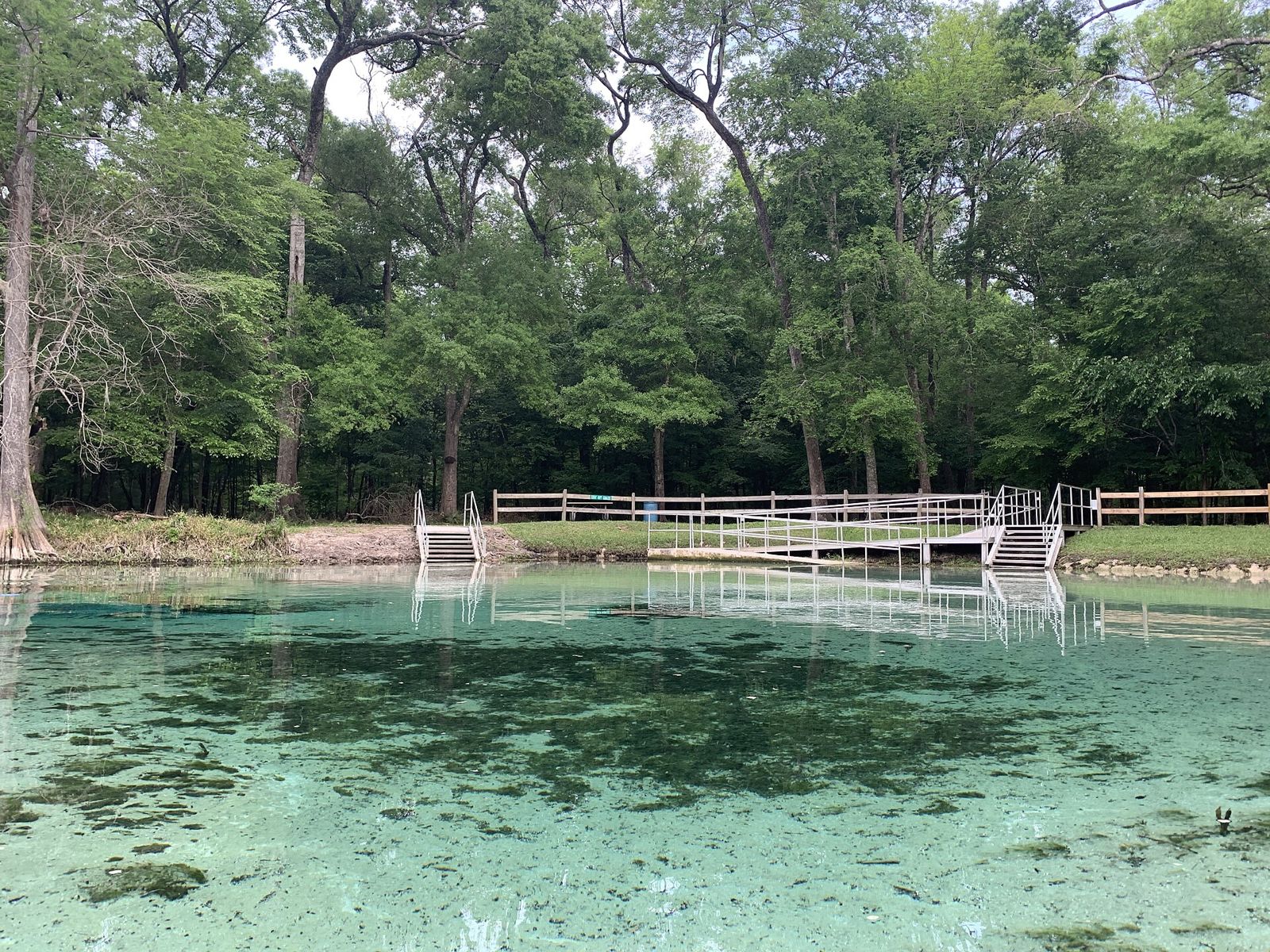
Clear green water at Rum Island Spring with a wooden ramp and railing
Rum Island Spring · LittleT889, CC BY-SA 4.0

Rentals & shuttles

Outfitters we could verify

We only list outfitters whose current details we could confirm on their own sites. Call before you drive, because hours change in the off-season.

Rum 138 · 2070 SW CR 138, Fort White

  • Kayaks, canoes and SUPs, with shuttle included. Single kayak $49, double $69, canoe $65, SUP $55, plus a $3/person park fee.
  • Bring-your-own-boat shuttles: $29 to US 27, Rum Island or SR 47; $39 to US 441; $70 to US 129.
  • Launches 9 a.m.–1 p.m., off the water by 4:30. Phone 386-454-4247.

Anderson's Outdoor Adventures · Poe Springs Park

  • Guided and shuttled paddles, including 8 Springs in 8 Miles and the Ginnie paddle.
  • 16-ft pontoon rentals (up to 6 people, 50 hp), delivered to Sandy Point on the Santa Fe or to the Anderson or Hart Springs ramps on the Suwannee. Operators need boater safety education.
  • Phone 352-507-0059.

Ginnie Springs Outdoors

Canoe and kayak rentals for use on the river by Ginnie. Rental boats go upstream only and must be back by 5 p.m. Day passes stop selling at 3 p.m. Phone 386-454-7188.

Santa Fe Canoe Outpost · US 441

Now a free City of High Springs launch for your own boat. No rentals and no shuttles.

River levels & safety

Read the river before you launch

These four USGS gauges cover the water in this guide. Numbers load live from USGS when you open the page.

Santa Fe at US 441

498 cfs
32.04 ft · snapshot Oct 17, 2026, 9 a.m. ET
USGS 02321975 →

Santa Fe near Fort White

1,020 cfs
Below normal (median for the date ≈ 1,310) · snapshot
USGS 02322500 →

Santa Fe at US 129 (Hildreth)

1,200 cfs
7.12 ft · snapshot
USGS 02322800 →

Suwannee at Branford

5,770 cfs
8.61 ft · above normal (median ≈ 3,840) · snapshot
USGS 02320500 →

Showing the Oct 17, 2026 snapshot. Live values replace these when USGS responds. Provisional data, subject to revision. Feet are the reading on the gauge, not water depth.

Low water (now, on the Santa Fe)

  • The springs are at their clearest, and Sunbeam and other riverbed vents show.
  • Limestone ledges, logs and grass beds come up, so props hit bottom above SR 47 and below Wilson. Trim up and go slow.
  • Paddlers may have to drag over shallow spots on the upper river.
  • Some small springs stop flowing. Poe stopped this summer.

High water

  • The river turns dark with tannins and the springs lose their color. Branford Spring floods over.
  • The current gets strong, and debris comes downriver.
  • FWC turns on idle-speed, no-wake zones on the Suwannee, Santa Fe and lower Ichetucknee once the river reaches set gauge heights. Check the zone table.
  • Parks close swim areas and sometimes ramps.

Jumping sturgeon (May–Oct)

Gulf sturgeon can weigh over 100 pounds, and they leap out of the Suwannee, mostly from May to early August and most often at dawn and dusk. FWC lists holding areas just below the Santa Fe confluence and near Rock Bluff, both on our stretch. Slow down, keep everyone off the bow and wear life jackets. Report a strike to FWC at 888-404-3922.

Life jackets

Florida requires a Coast Guard–approved wearable life jacket for each person on board, and kids under 6 must wear one while a small boat is moving. On a kayak, wear yours. Coast Guard data show most boaters who drown weren't wearing one.

Motor rules on the Ichetucknee

The motor ban covers only the upper Ichetucknee inside the state park, above US 27. The roughly 3 miles below US 27 to the Santa Fe are open to boats, but they're shallow and lined with homes, so idle through. Local counties have asked FWC to make it a no-wake zone.

Divers and swimmers

Cave divers use Devil's Ear, Little River and other vents. Give a divers-down flag 100 feet of room on the river, and drop to idle if you have to pass closer. If you snorkel in the riverbed at Sunbeam or the Devil's, fly a flag yourself.

Wind, storms & float plans

The Suwannee is wide enough for wind to build a chop, and summer afternoons bring lightning. Get off the water early. Leave a float plan with someone on land (FSP float plan form), and know that cell coverage is spotty in the river valley.

Manatees & siphons

Manatees use the lower Suwannee and its springs, mostly well downriver of here. Sightings near Branford are uncommon, but idle if you see one. On the Santa Fe, water drains back underground at siphons such as the Big Awesome Siphon above SR 47. Never swim near one.

Florida law requires anyone born on or after Jan 1, 1988, to carry a boating safety education ID to run a boat with 10 hp or more. That includes rented pontoons. The water management district's river information line is 386-362-1001.

Stay on the river

Put in close to home

Santa Fe Basecamp is a private 2-bedroom guest house on 15 wooded acres along the lower Santa Fe near Branford. It sleeps 5 and is pet-friendly.

  • Kayak from the riverbank at the back of the property
  • Branford's free ramps are a short drive away
  • Ichetucknee about 8 miles by road, Ginnie about 18
Check dates on Airbnb
Or book on Vrbo

River questions

Can I take a motorboat to Ginnie Springs?

Yes. Ginnie sits on the Santa Fe about 3.8 river miles upstream of the SR 47 ramp, and the park has its own ramp. To land or use the springs you pay Ginnie's admission ($25 per adult March–October, $20 November–February). In low water, watch for limestone, logs and grass beds above SR 47, so a small boat with a tilt motor is the safe choice. Slow to idle near dive flags at Devil's Ear. Ginnie doesn't allow jet skis or pets on the property.

Is the Ichetucknee River open to boats?

Paddle craft, yes. Motors, only on the lower river. Inside Ichetucknee Springs State Park, the upper river above the US 27 bridge, motorized boats are banned. Below US 27, the roughly three miles through Three Rivers Estates down to the Santa Fe are open to boats, but they are shallow (around 4 feet on average, under 2 feet in spots). Columbia and Suwannee counties backed a petition in 2025 to make that stretch a no-wake zone, and as of Oct 17, 2026, we haven't found a final FWC decision. In the park, the Midpoint tube launch has been closed for repairs since March 17, 2026. Tubers launch from the South Entrance until 5 p.m.

What are the best springs by boat from Branford?

From the Ivey Memorial Park ramp in Branford (Suwannee River mile 76): Branford Spring is at the ramp, Little River Springs and Ruth Spring are about 4.5 to 5 miles upstream, Troy Spring is 6.7 miles (its swim area has been closed since Oct 13, 2026) and Royal Spring is about 14 miles. Downstream, the Santa Fe comes in at 10 miles, Pothole Spring is about 18 and Gornto about 21. Rock Bluff Spring is private, so you can look but not land.

Where can I rent a kayak or get a shuttle on the Santa Fe?

Rum 138 in Fort White rents kayaks, canoes and paddleboards with shuttle included. Launches run 9 a.m. to 1 p.m., and trips finish by 4:30 p.m. Anderson's Outdoor Adventures at Poe Springs Park runs the 8 Springs in 8 Miles paddle and bring-your-own-boat shuttles, and it rents pontoon boats on the Santa Fe and Suwannee. Ginnie Springs rents boats that have to paddle upstream and come back by 5 p.m. The Santa Fe Canoe Outpost on US 441 is now a free city launch and no longer rents.

Do I need to worry about jumping sturgeon?

On the Suwannee, yes, from about May through October. They jump most from May to early August, especially at dawn and dusk. FWC lists holding areas just below the Santa Fe confluence and near Rock Bluff, both in our area. Keep your speed down, keep people off the bow and wear life jackets.

How do I know if the river is too low or too high?

Check the live USGS gauges on this page before you go. When the Santa Fe is low, shoals, rocks and grass come up and motors get chewed, but the springs are clearest. When it's high, the water turns dark, springs like Branford flood and lose their color, and FWC switches on idle-speed zones. The Suwannee is wide and catches wind, so check the forecast too.

Can we launch a kayak from the guest house?

Yes. The river is at the back of the property. If we're on-site, send a quick message first. We share the exact location after you book.

Sources

All descriptions are our own. Facts come from the sources below, and we checked closures, fees and hours against official pages on Oct 17, 2026. If anything here disagrees with an official source, go by the official source.

River guest house · 5.0 ★Book on Airbnb